Thursday, October 27, 2011
AR Thoughts + 1968 student strike
I am really inspired to continue in the medium, but i think the goal should be ultimately to integrate the technology into our everyday lives.
AR needs to go beyond a gimmick, and some how be utilized in a better way to further its usefulness, such as AR that is wrapped around a hard hat so you can find out information about a construction site, or a windshield in a car that gives you traffic info and general diagnostics.
I'm going to look into AR better to try to make is smoother, and better to use. I think that it needs to break out of the cellphone realm a little bit.
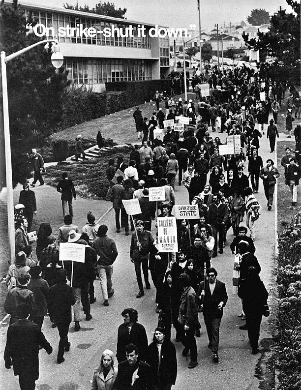
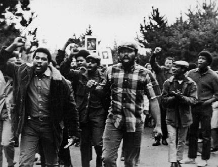
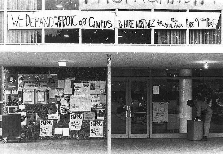
Our project was able to place the 1968 student strike, the largest problem was picture placement that moved around, when doing a history based locative project, its very important to have the locations be consistent. To further expand this project, i would have liked to set up 3d models to show the amount of protesters to give a full integrated view of the protests on campus.
Sunday, October 23, 2011
GoCars Reportback
My experience with the gocars through sf was sure interesting, but i felt it to be a bit lacking at times. for someone from the bay area, i know all the basic tourist destinations. I feel a large improvement in this tech would be to encourgage more random movement and tell you details about where you are, no matter what. Below is the map of our route:


Thursday, October 20, 2011
1968 Student Strike
Genevieve Hastings and I have deided to use layAR to overlay photos from the 1968 student strike. This will paint a picture in rememberence of this struggle of our schools history and also place historical photographs in the physical space in which they came.
Tuesday, October 4, 2011
Re-imagining Space: Freeways to Parkways
The Cypress Viaduct freeway was built in the 1950's and cut through west oakland. The freeway segregated space in such a dramatic way that it truly effected the feel of a formerly unified community. It's main goal was to assist commuters from newly built suburbs such as livermore and dublin faster access to San francisco, without driving through the neighborhoods and warehouse districts of west oakland.
The freeway collapsed after the Loma Prieta earthquake, and it was decided to never be rebuilt in the same way. Today the old cypress freeway is known as Mandela Parkway, which connects emeryville to west oakland. The space was radically re-imagined, where concrete and darkness stood, now grows trees and bicycle paths. My project creates interactive space that not only chronicles the history of this specific freeway and the results of a major disaster. explores how freeways can and do effect space drastically, and through natural disasters we can redefine space and our relations to it. With these ideas in hand, communities can consider how they want their spaces to look like, hopefully without the assistance of earthquakes.

The freeway collapsed after the Loma Prieta earthquake, and it was decided to never be rebuilt in the same way. Today the old cypress freeway is known as Mandela Parkway, which connects emeryville to west oakland. The space was radically re-imagined, where concrete and darkness stood, now grows trees and bicycle paths. My project creates interactive space that not only chronicles the history of this specific freeway and the results of a major disaster. explores how freeways can and do effect space drastically, and through natural disasters we can redefine space and our relations to it. With these ideas in hand, communities can consider how they want their spaces to look like, hopefully without the assistance of earthquakes.

Subscribe to:
Posts (Atom)